
Interactive Geotagging
PhotoLinker is an interactive geotagging tool.
Photos can be automatically geotagged by matching them to a GPS track. Proposed linking points are displayed on a map and updated as criteria are changed. Photos can also be manually geotagged by pinpointing a location on a map, entering the coordinates manually, or tagging them to waypoints.
All three modes save latitude and longitude to the photo (and altitude when available). You choose whether the city, state, country and elevation are saved to the photo in PhotoLinker preferences. PhotoLinker queries either google.com [maps.google.com] (default), Microsoft's Terraserver [terraserver-usa.com] or geonames.org to find the city, state and country corresponding to the latitude and longitude data.
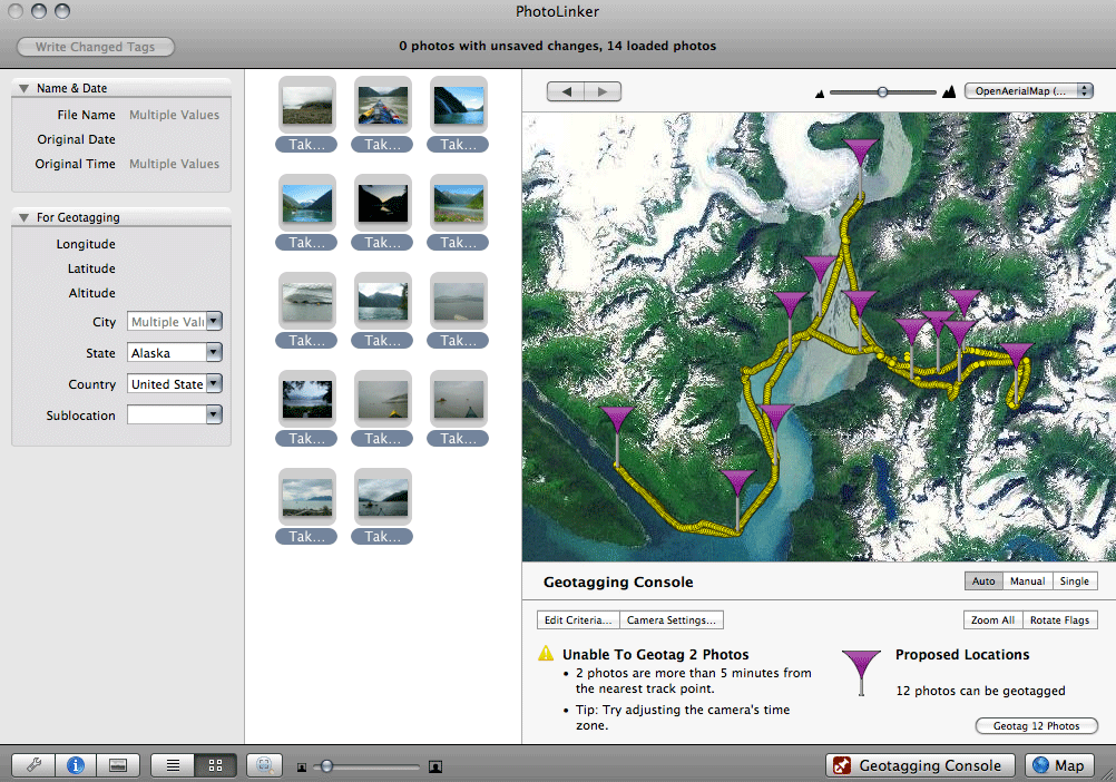
Auto Mode
Click for the full screenshot.
Auto mode automatically links track points to your photos based on your criteria. This is a highly efficient method for processing many photos at once. The linking options allow you to choose when a track point will be saved to a photo.
Select: "Edit Criteria..."
- The first option allows you to place a restriction on the temporal distance between the nearest track point and the time the photo was taken (default: 300 seconds/5 minutes) from nearest track point).
- The second option allows you to place a restriction on the physical distance between the two track points surrounding the time the photo was taken.
- Selecting AND requires both critieria to be met before linking will occur. Selecting OR will link if one of the two criteria are met.
- If no time or distance criteria are selected, linking will occur to the nearest recorded point or time-weighted average (as selected) without restriction.
- You can choose to link the nearest recorded point in time, or the time weighted average point (if one exists, otherwise the photo will be ignored).
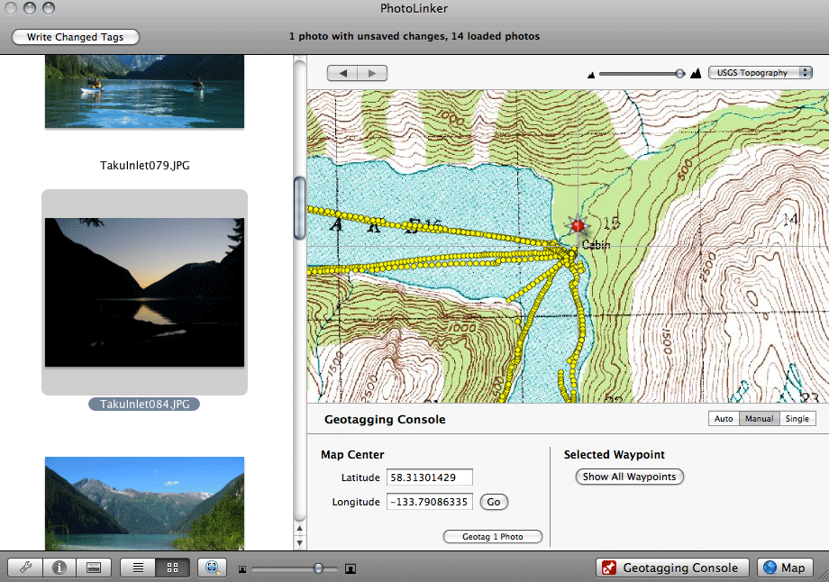
Manual Mode
Click for the full screenshot.
Use manual mode to geotag to photos without associated tracks-those taken at camp when the GPS is off for example, photos that didn't meet criteria set in auto mode, or photos associated with a waypoint-such as "Grandma's house".
- Use Map Center to pinpoint a spot on the map. Geotag all selected photos to that point.
- Select a waypoint to geotag to selected photos.
- Enter your own coordinates, click "go" to zoom coordinates to map center and geotag all selected photos to that point.
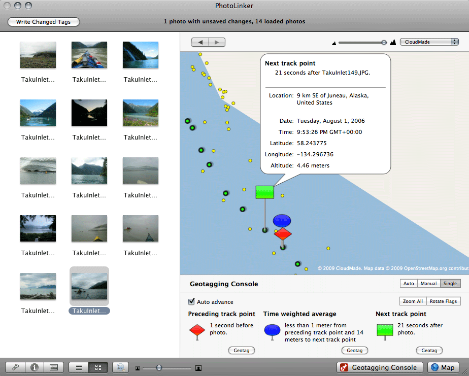
Single Mode
Click for the full screenshot.
When one photo is selected, single mode displays the two track points closest in time to the time stamp on your photo as well as a "Time weighted average". Clicking "Geotag" on any of these options will immediately save the latitude and longitude to the photo.
- The "Preceding point" is the closest track point in time prior to the time stamp on the photo. Similarly, the "Next point" is the closest track point in time after the time stamp on the photo.
- Although not a real track point, there is also a "Time weighted average" latitude/longitude you can choose to save to the photo.